For centuries, the remains of once-thriving civilizations lay buried beneath dense jungles, desert sands, and ocean floors. Explorers searched in vain, guided only by fragmented maps and ancient legends. Today, a revolution in remote sensing, aerial surveying, and computational archaeology has changed everything. The story of lost ancient cities discovered in recent decades reads like science fiction, yet every finding is grounded in rigorous scientific method.
From LiDAR laser scanning that strips away rainforest canopy to satellite multispectral imaging that reveals structures invisible to the naked eye, modern technology has become the archaeologist’s most powerful ally. These tools have not only confirmed long-suspected sites but have also revealed entirely unknown urban centers, forcing historians to reconsider established narratives about human settlement, trade, and cultural development.
In this comprehensive exploration, we examine seven remarkable cases where advanced technology led researchers to rediscover ancient civilizations. Each case demonstrates how the intersection of science and archaeology continues to reshape our understanding of the ancient world.
How Modern Technology Is Revolutionizing Archaeological Discovery
The transformation of archaeology from a discipline reliant on shovels and intuition to one powered by space-age technology has been nothing short of extraordinary. Remote sensing technologies, first developed for military and geological applications, have become indispensable tools for locating and mapping ancient sites that would otherwise remain hidden for centuries.
LiDAR (Light Detection and Ranging) technology, which uses pulsed laser light to measure distances to the Earth’s surface, has proven particularly revolutionary. When mounted on aircraft, LiDAR can penetrate dense vegetation and create precise three-dimensional maps of the terrain below. This capability has led to some of the most significant archaeological discoveries of the twenty-first century, particularly in tropical regions where jungle canopy had previously made ground surveys nearly impossible.
Satellite imagery, including both optical and radar-based systems, offers another critical tool. Satellites equipped with synthetic aperture radar (SAR) can detect subtle variations in soil moisture and vegetation patterns that indicate buried structures. Multispectral imaging, which captures light beyond the visible spectrum, can reveal ancient irrigation channels, roads, and building foundations that are invisible at ground level. According to research published in Nature, these technologies have increased the rate of new archaeological site identification by an estimated 400% compared to traditional survey methods.
Ground-penetrating radar (GPR), magnetometry, and electrical resistivity tomography complete the modern archaeologist’s toolkit, enabling non-invasive subsurface investigation that can map entire buried cities without disturbing a single grain of soil.
1. The Maya Megalopolis Beneath the Guatemalan Jungle
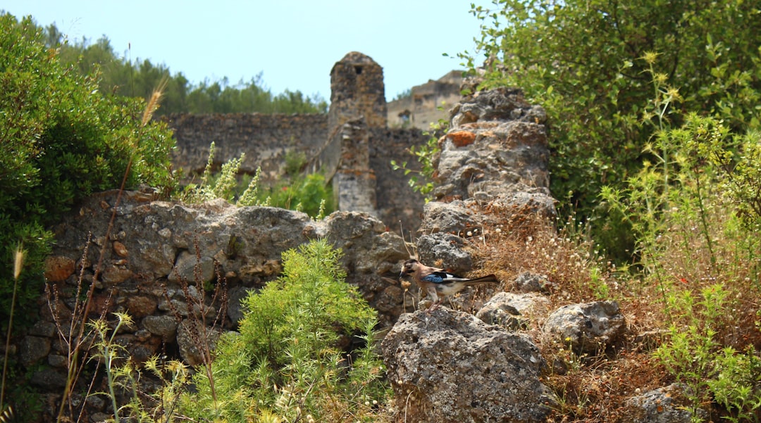
Perhaps the most spectacular LiDAR-driven discovery in recent years is the identification of a vast Maya urban network hidden beneath the dense tropical forest of northern Guatemala’s Peten region. In research campaigns conducted between 2016 and 2022, aerial LiDAR surveys revealed more than 60,000 previously unknown structures, including pyramids, palaces, elevated causeways, and sophisticated agricultural terraces.
The scale of these findings fundamentally altered scholarly understanding of Maya civilization. Prior estimates of the Maya population in the Classic period (250-900 CE) ranged from one to two million. The LiDAR data suggested the actual population may have been between 10 and 15 million, making the Maya lowlands one of the most densely populated regions in the pre-industrial world.
Among the most significant individual discoveries was a massive pyramid at the site of Tikal that had been misidentified as a natural hill for decades. The LiDAR scans also revealed an extensive network of defensive fortifications, including walls, ditches, and ramparts, indicating that Maya warfare was far more organized and large-scale than previously believed. Researchers found evidence of interconnected road systems spanning hundreds of kilometers, suggesting a level of political and economic integration comparable to ancient Rome.
As our coverage of ancient civilizations and geological evidence has explored, the discovery of lost urban centers often challenges established historical timelines.
2. Angkor’s Hidden Suburbs: A Medieval Mega-City Revealed
While Angkor Wat has been known to the Western world since French naturalist Henri Mouhot published his accounts in the 1860s, the true extent of the Angkor urban complex remained unknown until airborne LiDAR surveys began in 2012. The results were staggering: Angkor was not merely a collection of temples but the center of the largest pre-industrial city ever documented, sprawling across more than 1,000 square kilometers.
The LiDAR data revealed an intricate urban landscape of residential neighborhoods, sophisticated water management infrastructure, agricultural zones, and road networks that extended far beyond the temple complexes. The hydraulic engineering was particularly impressive, with reservoirs, canals, and distribution channels capable of managing the extreme seasonal variations between monsoon floods and dry-season drought.
Researchers from the University of Sydney’s Greater Angkor Project estimated the city’s peak population at between 750,000 and one million inhabitants during the twelfth and thirteenth centuries, making it the most populous city on Earth at that time. The discoveries also provided crucial evidence for understanding the civilization’s decline, revealing that the water management system’s failure, likely driven by climate change and deforestation, contributed to Angkor’s eventual abandonment.
3. Pompeii and Herculaneum: New Discoveries Beneath the Ash
The eruption of Mount Vesuvius in 79 CE preserved the Roman cities of Pompeii and Herculaneum under meters of volcanic ash, creating an unparalleled archaeological time capsule. While excavations have been ongoing since the eighteenth century, modern technology has revealed that approximately one-third of Pompeii remains unexcavated, and recent investigations have uncovered remarkable new findings.
Ground-penetrating radar surveys conducted in the unexcavated Regio IX quarter in 2023 and 2024 identified a complex of previously unknown buildings, including what appears to be a large public bathhouse and an adjacent commercial district. Advanced CT scanning of sealed rooms has revealed intact furniture, food stores, and personal belongings without the need for physical excavation, preserving fragile artifacts that traditional digging might destroy.
At Herculaneum, artificial intelligence and advanced imaging techniques have made it possible to read carbonized papyrus scrolls from the Villa of the Papyri, a discovery that could unlock an entire lost library of ancient Greek and Roman philosophical texts. The Smithsonian Magazine has documented how machine learning algorithms trained on X-ray tomography data can now distinguish ink from papyrus on scrolls that were fused into solid carbon cylinders by volcanic heat.
4. Teotihuacan’s Underground Secrets
Teotihuacan, the ancient Mexican metropolis that at its peak around 450 CE housed an estimated 125,000 people, continues to yield extraordinary discoveries through modern technology. The identity of its builders remains one of archaeology’s great mysteries, as no written records have been found despite the city’s enormous scale and influence across Mesoamerica.
In 2003, a tunnel beneath the Temple of the Feathered Serpent (Pyramid of Quetzalcoatl) was discovered using ground-penetrating radar. Subsequent robotic exploration and careful excavation revealed a 103-meter-long passage leading to three chambers located 18 meters below the surface. Inside, archaeologists found more than 75,000 artifacts, including greenstone figurines, pyrite mirrors, shells from both the Pacific and Atlantic coasts, and quantities of liquid mercury, possibly representing an underworld river in the city’s cosmological beliefs.
Muon tomography, a technique borrowed from particle physics that uses naturally occurring cosmic-ray muons to create density maps of large structures, was applied to the Pyramid of the Sun in 2017. The results revealed previously unknown internal chambers and passages, suggesting the pyramid may contain undiscovered burial chambers or ritual spaces. Thermal imaging conducted by drone has also identified anomalies in the Avenue of the Dead that may indicate buried structures extending the known boundaries of the city.
5. Dwarka: India’s Legendary Underwater City
The ancient city of Dwarka, described in Hindu scriptures as the kingdom of Lord Krishna, was long considered purely mythological. However, underwater archaeological surveys using side-scan sonar and sub-bottom profiling off the coast of modern Dwarka in Gujarat, India, have revealed extensive submerged structures dating back thousands of years.
Initial surveys conducted by the National Institute of Oceanography in the 1980s identified stone walls, bastions, and what appeared to be a planned urban layout at depths of 5 to 12 meters below sea level. More recent surveys using multibeam sonar and remotely operated vehicles (ROVs) have mapped a much larger area, revealing a settlement that extends over several square kilometers on the continental shelf.
The submerged structures include what researchers interpret as a fortified harbor, residential quarters, and ceremonial platforms. Thermoluminescence dating of pottery recovered from the site has yielded dates ranging from 1500 BCE to 500 BCE, while some researchers argue that deeper structures could be significantly older. The findings have sparked debate about post-glacial sea level rise and its impact on coastal civilizations throughout South and Southeast Asia.
6. The Lost Cities of the Kalahari and Amazonia
Two of the most significant recent discoveries have come from regions long thought to have been too inhospitable for large-scale urban development. In the Amazon basin, LiDAR surveys conducted between 2019 and 2024 have revealed extensive networks of pre-Columbian settlements, earthworks, and road systems that indicate a population far larger and more urbanized than previously assumed.
In the Llanos de Mojos region of Bolivia, researchers identified more than 20 previously unknown settlement sites connected by elevated causeways spanning hundreds of kilometers. The settlements featured pyramidal mounds, water reservoirs, and evidence of large-scale landscape modification, including raised agricultural fields designed to manage seasonal flooding. These findings suggest that the Amazon supported complex societies with populations in the millions before European contact.
Meanwhile, satellite analysis of the Kalahari Desert in southern Africa has identified anomalies consistent with large stone structures buried beneath the sand. While investigation is still in early stages, preliminary ground-truthing has confirmed the presence of stone walls and foundation remnants at several sites, lending credibility to longstanding oral traditions among local communities about ancient cities in the region. This research, discussed by National Geographic, demonstrates how technology validates indigenous knowledge systems.
These discoveries across multiple continents echo themes explored in our analysis of deep ocean mysteries and unexplained phenomena, where advanced technology similarly reveals hidden aspects of our world.
7. Thonis-Heracleion: Egypt’s Sunken Port City
Thonis-Heracleion, once Egypt’s greatest Mediterranean port city, sank beneath the waters of Aboukir Bay around the eighth century CE, likely due to a combination of earthquakes, tsunamis, and soil liquefaction. For more than a millennium, its existence was known only from scattered references in ancient Greek and Egyptian texts. Its rediscovery in 2000 by French underwater archaeologist Franck Goddio stands as one of the most significant marine archaeological achievements in history.
Using a combination of side-scan sonar, nuclear magnetic resonance magnetometry, and satellite positioning systems, Goddio’s team mapped the entire sunken city across an area spanning nearly 11 square kilometers beneath 10 meters of water and several meters of sediment. The discoveries included more than 700 ancient anchors, 69 ships, gold coins, bronze statues, and a massive temple to the god Amun with intact ceremonial objects still in place.
Perhaps most significantly, researchers recovered inscribed stone slabs (steles) that confirmed the city’s identity and its role as Egypt’s primary customs port for Mediterranean trade. The city’s well-preserved state beneath the protective sediment has provided unprecedented insights into Ptolemaic-era (305-30 BCE) maritime commerce, religious practices, and urban planning.
Comparative Overview: Technologies and Discoveries
| Lost City / Site | Location | Key Technology | Approximate Date | Major Finding |
|---|---|---|---|---|
| Maya Megalopolis | Guatemala | Airborne LiDAR | 250-900 CE | 60,000+ structures, population revised to 10-15 million |
| Greater Angkor | Cambodia | LiDAR, SAR Satellite | 800-1400 CE | 1,000 km2 urban sprawl, largest pre-industrial city |
| Pompeii / Herculaneum | Italy | GPR, CT Scanning, AI | 79 CE (preserved) | Unexcavated districts, readable carbonized scrolls |
| Teotihuacan | Mexico | Muon Tomography, GPR | 100 BCE – 550 CE | Hidden tunnel with 75,000+ artifacts, mercury rivers |
| Dwarka | India | Sonar, ROVs | 1500-500 BCE | Fortified harbor and urban layout submerged offshore |
| Amazonian Cities | Bolivia / Brazil | LiDAR, Satellite | 500 BCE – 1500 CE | Causeways, pyramids, millions-strong populations |
| Thonis-Heracleion | Egypt | Sonar, Magnetometry | 800 BCE – 800 CE | Complete sunken port with 700+ anchors, 69 ships |
The Future of Archaeological Discovery
The pace of discovery shows no signs of slowing. Machine learning algorithms are now being trained to identify potential archaeological sites from publicly available satellite imagery, a process that could eventually survey the entire planet’s surface for signs of buried settlements. Crowdsourcing platforms like GlobalXplorer invite citizen scientists to help scan satellite images, dramatically expanding the human labor available for site identification.
Drone technology continues to advance, with autonomous survey drones capable of conducting LiDAR and photogrammetric surveys of areas that are difficult or dangerous to access. Underwater robotics are becoming more capable and affordable, opening new frontiers in marine archaeology. Perhaps most exciting is the application of environmental DNA (eDNA) analysis, which can detect traces of ancient human activity in soil samples without any visible artifacts.
These technologies collectively suggest that many of humanity’s lost ancient cities discovered so far may represent only a fraction of what remains hidden. Estimates suggest that less than 10% of the world’s archaeological heritage has been documented, and the vast majority of underwater sites remain completely unexplored. As technology continues to advance, each year brings the possibility of finding civilizations that history forgot.
Frequently Asked Questions
What is LiDAR and how does it help find lost cities?
LiDAR (Light Detection and Ranging) is a remote sensing technology that uses pulsed laser light to create detailed three-dimensional maps of terrain. When mounted on aircraft, it can penetrate dense vegetation like jungle canopy, revealing structures hidden beneath. LiDAR has been instrumental in discovering ancient Maya cities in Guatemala, mapping the full extent of Angkor in Cambodia, and identifying pre-Columbian settlements in the Amazon basin. The technology works by emitting millions of laser pulses per second and measuring the time each pulse takes to return, creating point clouds that can be processed into highly accurate topographic models.
How many lost ancient cities are still undiscovered?
While it is impossible to give a precise number, archaeologists estimate that the vast majority of ancient settlements remain undocumented. Studies using satellite-based predictive modeling suggest there could be hundreds of thousands of unrecorded archaeological sites worldwide. In regions like Central America, the Amazon basin, Central Asia, and sub-Saharan Africa, LiDAR and satellite surveys consistently reveal far more sites than previously predicted. Marine archaeologists estimate that rising sea levels since the last Ice Age submerged millions of square kilometers of formerly habitable coastal land, potentially hiding thousands of settlements.
Can satellites really see buried structures from space?
Yes, though not in the way most people imagine. Satellites do not see through the ground directly. Instead, they detect indirect evidence of buried structures. Differences in soil composition above buried walls or foundations affect moisture retention, which in turn affects vegetation growth patterns. These subtle variations, often invisible to the naked eye, can be detected by multispectral and infrared satellite sensors. Synthetic aperture radar (SAR) satellites can also detect very slight surface elevation differences caused by subsurface structures, even in arid or unvegetated terrain.
What is the oldest lost city ever discovered using modern technology?
One of the strongest candidates is Gobekli Tepe in southeastern Turkey, identified through ground-penetrating radar surveys that revealed the full extent of the site’s monumental architecture. Dated to approximately 9500 BCE, Gobekli Tepe predates Stonehenge by about 6,000 years and challenges the conventional understanding that monumental construction required settled agricultural societies. In marine contexts, submerged structures off the coasts of India, Japan, and the Mediterranean may date to periods of lower sea levels during the last Ice Age, potentially making them even older, though dating remains controversial.
How does artificial intelligence contribute to finding lost cities?
AI and machine learning contribute to archaeological discovery in several ways. Algorithms can be trained to recognize patterns in satellite imagery that indicate potential archaeological sites, scanning vast areas far more quickly than human analysts. AI is also used to process and interpret LiDAR data, automatically identifying man-made features in complex terrain models. At sites like Herculaneum, machine learning has enabled researchers to read ancient texts on carbonized scrolls that were previously considered permanently lost. Predictive modeling using AI can also identify areas with high archaeological potential based on environmental and geographic variables.
This article is for informational purposes only. The archaeological findings discussed are based on published research and may be subject to revision as new evidence emerges.
Votre analyse